Earthquake light is a phenomenon preceding or following an earthquake that caused by several things, these are:
1. Electric fields caused by tectonic movement of rocks containing quartz. Quartz is a piezoelectric mineral and abound in earth. Piezoelectric means that it can generate an electric field.
2. The disruption of local magnetic field. This hypothesis is not scientifically verified.
3. The light might be a result of ionization or plasma-chemical reaction of radon gas. Note that before an earthquake occur , there is unusual amount of radon gas near the epicentrum.
Long before the age of modernism, a haiku poetry made by an unknown Japanese:
The earth speaks softly
To the mountain
Which trembles
And light the skyThis light could be multicolored, reddish, or just white. Some report of earthquake lights are:
1. Reddish arc visible in Yogyakarta, Indonesia, after May 22, 2005 Earthquake. The earthquake was scaled at 6,9 M
2. Red lightning visible in Aceh, Indonesia before 2004 Boxing Day Tsunami. This lightning was so clear "like a fire". The weather was clear.
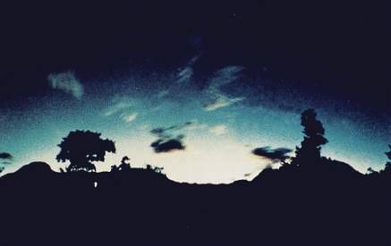
3. Mt. Kimyo Earthquake light as seen on photo in the left. It was taken by T.Kuribayashi on Sep 26, 1966. It was triggered by Matsushiro earthquake swarm occured in 1965-1969.
4. Sichuan earthquake light visible 30 minutes before the earthquake. You could find the video easily in Youtube. I'm so bored watching that video. ~_~.
5. 2007 Peru Earthquake light. Anyone may see the video below.
6.Recently, 2010 Chile Earthquake light. Residents reported that they were felt somewhat uncomfort to sleep, and then they saw "Very Bright Light" emerging from Pacific Ocean.

 *) note that an Indonesian (supernatural?) group has predicted this earthquake using somewhat unscientific way ( 11 days cycle of disaster--->next disaster is about to blast Indonesia on May 20, 2010), and this is the prove.
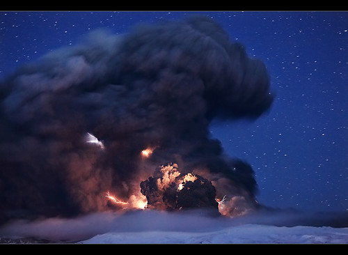

